
Last updated: October 2021
The North Green Belt was developed and built up in connection to investments and structures for the 2008 Expo. (Ref. 1,2) The North Green Belt is a series of connections extending the green corridor and network of green spaces in Zaragoza, with the Ebro and Gallego rivers as the two main axes of the belt. (Ref. 1,2)
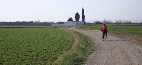
Source: Ref. 3
Overview
Nature-based solution
- Grey infrastructure featuring greens
- Blue infrastructure
- Riverbank/Lakeside greens
- Parks and urban forests
- Green corridors and green belts
Key challenges
- Green space, habitats and biodiversity (SDG 15)
- Habitat and biodiversity restoration
- Green space creation and/or management
- Regeneration, land-use and urban development
- Regulation of built environment
- Health and well-being (SDG 3)
- Enabling opportunities for physical activity
- Creation of opportunities for recreation
Focus
Creation of new green areas, Maintenance and management of urban nature
Project objectives
- Design a north green belt that fits and connects into the green ring around the whole city. (ref 5)
- Further incorporate the Gallego river into the green networks of the city. (Ref. 4)
- Develop and connect the former industrial areas along the banks of the Ebro as green spaces in the city (ref 4)
- Increase the vegetation along with the bike and pedestrian paths of the green corridor (ref 4)
- Provide clear and thorough signage for users of the green corridor. (ref 5)
- Increase access of citizens to "little known" areas of and around the city. (ref 1)
Implementation activities
-The whole north belt is divided into six sections, each completed as a sub project of the larger ring: 1. Section of the Ebro 5.3 km long; 2. Gallego Sur 3.8 km long; 3. Gellego Norte 6.3 km; 4. San Gregorio 5.4 km; 5. Parque Goya 5.2km; 6. Parque del Agua 3.9km or 4.1km (ref 1)
-Areas next to route will benefit from reforestation, creation of urban gardens, and equipment installations (Ref. 2)
- Provide signage (Ref. 2)
Biodiversity conservation or restoration-focused activities
Biodiversity restoration:
- Rehabilitate and restore damaged or destroyed ecosystems
- Restore ecological connectivity
Main beneficiaries
- Local government/Municipality
- Citizens or community groups
Governance
Management set-up
- Government-led
Type of initiating organisation
- Local government/municipality
Participatory approaches/ community involvement
- Unknown
Details on the roles of the organisations involved in the project
Ayuntamiento de Zaragoza (City Council) leading the project and providing maintenance budget (ref 1 and 2)
Project implemented in response to ...
... an EU policy or strategy?
Unknown
... a national policy or strategy?
Unknown
... a local policy or strategy?
Yes
(Urban Development Plan - Plan de Organizacion Urbana, Zaragoza 2007 )
Financing
Total cost
More than €4,000,000
Source(s) of funding
- Public local authority budget
- Other
Type of funding
- Earmarked public budget
- Direct funding (grants, subsidies, or self-financed projects by private entities)
Non-financial contribution
Unknown
Impacts and Monitoring
Environmental impacts
- Green space and habitat
- Promotion of naturalistic styles of landscape design for urban development
- Increased green space area
- Increased conversion of degraded land or soil
- Increased ecological connectivity across regeneration sites and scales
Economic impacts
- Unknown
Socio-cultural impacts
- Social justice and cohesion
- Improved access to urban green space
- Health and wellbeing
- Gain in activities for recreation and exercise
- Cultural heritage and sense of place
- Promotion of cultural diversity
- Other
Type of reported impacts
Achieved impacts
Presence of formal monitoring system
Unknown
Presence of indicators used in reporting
No evidence in public records
Presence of monitoring/ evaluation reports
No evidence in public records
Availability of a web-based monitoring tool
No evidence in public records
References
1. Heraldo. (2012). El anillo verde norte de Zaragoza, en una guía. Available at: Source link [Accessed 4 September 2020].
2. El Periodico de Aragon. (2012). Zaragoza completa su anillo verde con otros 30 kilómetros en el norte. Available at: Source link [Accessed 4 September 2020].
3. Rulando. (2010). Anillo Verde Norte. Available at: Source link [Accessed 4 September 2020].
4, Ayuntamiento de Zaragoza. (2017). Anillo verde Norte. [Not available in 2020].
5. Ayuntamiento de Zaragoza. (2017). Memoria. [Document provided].
6. Green Planet Architects. (2017). RECONVERSION EXPO ZARAGOZA 2008. Available at: Source link [Web platform under re-construction in 2020].
7. Ayuntamiento de Zaragoza. (n.d.). Biodiversidad y Naturaleza: Anillo verde Norte de Zaragoza, Trazado y Senalizacion. Available at: Source link [Accessed 4 September 2020].