
Last updated: October 2021
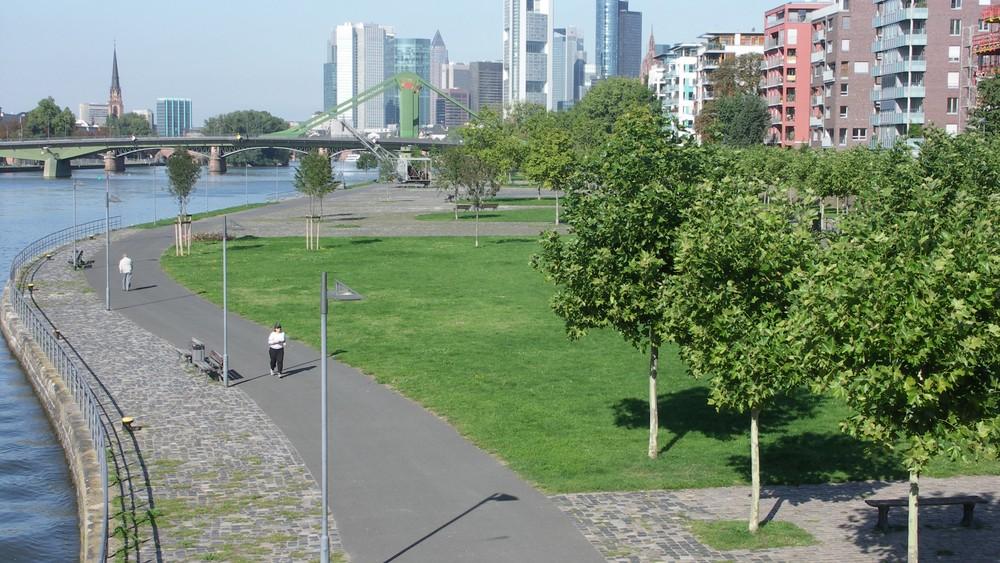
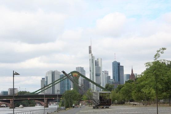
With the decline in industrial use, the grey harbour landscape of Frankfurt am Main became a habitat for rare plants. In 1986, the city council ordered transformation of the former industrial area into a public green space between the Main and the new residential area in the Ostend. The bright, spacious park with 2.1 ha surface was finished in 2000 (1) now welcoming locals for recreation and exercise while it also hosts a cultural summer festival and gives a home for local wall and fence lizards (1).
Source: https://frankfurt.de/themen/umwelt-und-gruen/orte/parks/parks-von-a-bis-z/weseler-werft
Overview
Nature-based solution
- Grey infrastructure featuring greens
- Blue infrastructure
- Riverbank/Lakeside greens
- Parks and urban forests
- Pocket parks/neighbourhood green spaces
Key challenges
- Water management (SDG 6)
- Stormwater and rainfall management and storage
- Green space, habitats and biodiversity (SDG 15)
- Green space creation and/or management
- Regeneration, land-use and urban development
- Conversion of former industrial areas
- Promote natural styles of landscape design for urban development
- Health and well-being (SDG 3)
- Creation of opportunities for recreation
Focus
Creation of new green areas, Maintenance and management of urban nature, Transformation of previously derelict areas
Project objectives
1. Regeneration of the former industrial area (1);
2. Creation of a new green area near the newly built neighbourhoods (1);
3. Organization of new recreation areas for Frankfurt citizens (2);
4. Improvement of the coastal drainage system (1).
Implementation activities
1. Sealed Paving removed and replaced by a lawn and pawing stones for better drainage (1)
2. New trees planted (1)
3. Routes for pedestrians and cyclists arranged (1)
4. Abandoned and derelict spaces redeveloped into a (semi)natural urban green area (1)
Main beneficiaries
- Citizens or community groups
Governance
Management set-up
- Government-led
Type of initiating organisation
- Local government/municipality
Participatory approaches/ community involvement
- Unknown
Details on the roles of the organisations involved in the project
The City Council of Frankfurt am Main initiated the transform the industrial area of the city center into a public green space between the Main and the new residential area in the Ostend (1). The redevelopment of the Weseler Werft was part of this large scale development. The implementation of the plans were carried out with the involvement of the private company Schneider - Plannungsgruppe Schenider. (1,2)
Project implemented in response to ...
... an EU policy or strategy?
Unknown
... a national policy or strategy?
Yes
(Urban redevelopment measures according to the § 136 of the German Building Code (BauGB). Focus on this regulation is the conversion of unused and post-industrial areas to residential areas and mixed used areas. (6))
... a local policy or strategy?
Yes
(1. The regional land use plan "Frankfurt/Rhein-Main 2020 - The European metropolitan region" (4)
2. The Main Riverside Master Plan 2015 (2))
Financing
Total cost
More than €4,000,000
Source(s) of funding
- Public local authority budget
Type of funding
- Earmarked public budget
Non-financial contribution
No
Impacts and Monitoring
Environmental impacts
- Water management and blue areas
- Increased protection against flooding
- Green space and habitat
- Promotion of naturalistic styles of landscape design for urban development
- Increased green space area
- Increased number of species present
- Restoration of derelict areas
Economic impacts
- Unknown
Socio-cultural impacts
- Health and wellbeing
- Gain in activities for recreation and exercise
- Cultural heritage and sense of place
- Protection of historic and cultural landscape / infrastructure
Type of reported impacts
Achieved impacts
Presence of formal monitoring system
Unknown
Presence of indicators used in reporting
No evidence in public records
Presence of monitoring/ evaluation reports
No evidence in public records
Availability of a web-based monitoring tool
No evidence in public records
References
1. Source link. (2017). Weseler Werft. Accessed on September 30, 2020, Source link
2. Schmal, P. and Becker, Annette. (2010). Stadtgrün / Urban Green: Europäische Landschaftsarchitektur Für Das 21. Jahrhundert / European Landscape Architecture for the 21st Century. Walter de Gruyter, Accessed on September 30, 2020, Source link
3. Planungsgruppe Schneider & Partner. (2017). Home. Accessed September 30 2020, Source link
4. Krüger-Roth, D., Ungeheuer, E., and Torns, F. (2005). Frankfurt/Rhein-Main 2020 - the European metropolitan region. Strategic Vision for the Regional Land Use Plan and for the Regionalplan Sudessen. Planungsverband Ballungsraum Frankfurt/Rhein-Main. Accessed September 30, 2020, Source link.
5. Stadt Frankfurt am Main. (2007). Stadtumbau Frankfurter Osten, Accessed on September 30, 2020, Source link
6. Stadt Frankfurt am Main. (2012). Report on urban development Frankfurt am Main 2012, Accessed on September 30, 2020, Source link
Source: https://www.erlebnisraum-frankfurt.de/reportagen/stadtteile/209-weseler-werft-ezb-und-osthafen.html?start=2
Source: https://www.erlebnisraum-frankfurt.de/reportagen/stadtteile/209-weseler-werft-ezb-und-osthafen.html?start=2