Cartagena, Cartagena (FUA), Colombia
City population: 1138298
Duration: 2013 – 2027
Implementation status: Ongoing
Scale: Meso-scale: Regional, metropolitan and urban level
Project area: unknown
Type of area: Previous derelict area, Residential, Protected Area, Cultural Heritage Area, Public Greenspace Area, Vacant or abandoned land, Mixed-use development (combination of residential, commercial, and/or industrial)
Last updated: April 2025

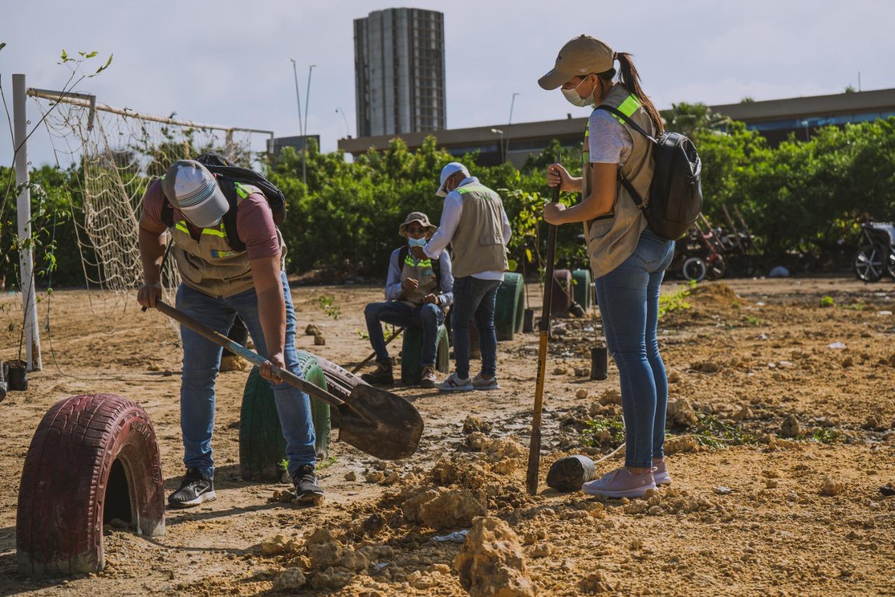
The Urban Forestry Plan for Cartagena, led by EPA Cartagena, outlines a comprehensive strategy for enhancing the city's green infrastructure. The plan focuses on selecting suitable tree species, planting, and management to achieve several goals: reducing heat through shade, creating microclimates, protecting against climatic events such as coastal erosion and windstorms, enhancing food security, and enhancing the landscape's beauty. Over 10 years, the plan aims to establish at least 100,000 additional trees, increase overall tree cover, enhance accessibility to green spaces, and build a main ecological structure based on natural resources and biodiversity. It also emphasises the importance of local knowledge and resources (ref 1). Formulated with community input, the plan commenced in 2013 and involved a detailed assessment of existing urban vegetation and climate conditions, utilising tools such as iTree. The development included international conferences and expert consultations to ensure a robust and informed approach (ref 1).

Community Request Boulevard of the Huellas de Alberto Uribe Neighborhood November 6, 2021
EPA Cartagena https://epacartagena.gov.co/web/verde-distrito-cartagena/

Overview

Nature-based solution

  • Grey infrastructure featuring greens
  • Alley or street trees and other street vegetation

Key challenges

  • Climate action for adaptation, resilience and mitigation (SDG 13)
  • Climate change adaptation
  • Green space, habitats and biodiversity (SDG 15)
  • Green space creation and/or management
  • Social justice, cohesion and equity (SDG 10)
  • Environmental education
  • Sustainable consumption and production (SDG 12)
  • Food scarcity / security

Principal problems in Functional Urban Area (FUA)

  • Climate-Related Hazards
  • Coastal hazards (e.g. erosion, flooding)
  • Heat stress & Extreme temperatures

Key priorities

Climate action (adaptation and/or mitigation), Biodiversity (conservation and/or restoration)

Focus

Creation of new green areas, Creation of any other green urban spaces, Maintenance and management of urban nature, Maintenance or upgrade of exisiting green spaces (e.g. parks), Strategy, plan or policy development, Creation of city-wide or neighborhood green and blue infrastrcuture protection or enhancement strategies/plans

Project objectives

The plan encompasses short-term, medium-term, and long-term objectives, accompanied by specific indicators for action and results. Over a period of ten years, the main goals include (ref 1): - Establishing a forest mass of at least 100,000 additional trees to those already existing, increasing tree canopy coverage. - Creating more accessible green areas for households. - Developing a primary ecological structure primarily of trees to be established in the city, incorporating biodiversity criteria as a guiding principle for actions. - Making a significant contribution to food security in urban areas. - Recognising local knowledge and prioritising the use of local resources. - Manage the existing urban heat island using the initial assessment as a reference point. - Aesthetic Improvement: Enhance the city's visual appeal with increased green spaces. - Community Engagement: Educate and involve local communities in tree planting and maintenance to foster a culture of environmental stewardship Originally, the plan covers a 10-year horizon, targeting the planting of 100,000 new trees and the maintenance of existing vegetation (ref 1). Currently, it has a goal of 300,000 new trees by 202

Implementation activities

The procedure for requesting a planting session is as follows: any city resident can request a session from the EPA, provided the location for planting is on public land (such as public spaces, sidewalks, parks, public transportation stations, public school grounds, streets, etc.). The EPA will then visit the site to determine the most suitable species to plant. They will supply the necessary plants, tools, and labor. In certain cases, the EPA may seek support from other public and private institutions for the planting sessions, with funding coming from public sources, including compensation activities from companies holding environmental licenses. Following the planting, the citizen who requested the session is responsible for maintaining the plants. While the EPA conducts monitoring, these activities are not structured. Each planting session is georeferenced and documented on the EPA's website (ref 1). Cartagena has 186,344 trees located in public spaces, a figure that does not include mangrove forests, the remnants of dry forest in La Popa Hill and Albornoz, or those planted on private properties (ref 3). Educational processes fundamentally complement the activities of planting and maintaining trees at three levels: i) schools and colleges, ii) action implementers, and iii) the general community.

Climate-focused activities

Climate change adaptation:

  • Increase urban vegetation cover to reduce urban heat island effect

Main beneficiaries

  • Citizens or community groups
  • Young people and children

Governance

Management set-up

  • Government-led

Type of initiating organisation

  • Local government/municipality

Participatory approaches/ community involvement

  • Consultation (e.g. workshop, surveys, community meetings, town halls)
  • Joint implementation (e.g. tree planting)
  • Citizen monitoring and review

Details on the roles of the organisations involved in the project

The plan is managed by Cartagena's Environmental Public Establishment (EPA), which coordinates with local government bodies, NGOs, companies, and community organizations (ref 1). the different Secretariats of the city ensure that all new infrastructure projects in the city incorporate green spaces as part of the urban development strategy (ref 2). The Office of Risk Management participates in the planning phase by providing insights on climate risks and vulnerabilities that need to be addressed through urban greening (ref 3). the Univ. Francisco José de Caldas performed the tree census, local residents, community leaders, and organizations are engaged in tree planting and maintenance activities, Private companies are invited to participate in the initiative through sponsorships (ref 2, 3)

Project implemented in response to ...

... an EU policy or strategy? Unknown
... a national policy or strategy? Unknown
... a local policy or strategy? Yes (The Urban Silviculture Plan adopted by Decree 0274 on February 10, 2017, by Mayor Manuel Vicente Duque and EPA Cartagena (ref 1))

Type of enablers

Governance innovations (such as public private partnerships)

Financing

Total cost

Unknown

Source(s) of funding

  • Public local authority budget
  • Corporate investment
  • Other

Type of funding

  • Earmarked public budget
  • Direct funding (grants, subsidies, or self-financed projects by private entities)
  • Donations

Non-financial contribution

Type of non-financial contribution
  • Provision of goods
  • Provision of labour
  • Provision of expertise
  • Provision of other services
Who provided the non-financial contribution?
  • Citizens (e.g. volunteering)
  • Private sector (businesses, financial institution)

Impacts and Monitoring

Environmental impacts

  • Climate change
  • Lowered local temperature
  • Expected lowered local temperature
  • Environmental quality
  • Improved air quality
  • Expected improved air quality
  • Reduced noise exposure
  • Expected reduced noise exposure
  • Green space and habitat
  • Increased green space area
  • Achieved increased green space area
  • Reduced biodiversity loss
  • Expected reduced biodiversity loss

Economic impacts

  • Unknown

Socio-cultural impacts

  • Social justice and cohesion
  • Increased access to healthy/affordable food
  • Expected increased access to healthy/affordable food
  • Health and wellbeing
  • Improved physical health
  • Expected improved physical health
  • Education
  • Increased knowledge of locals about local nature
  • Achieved increased knowledge of locals about local nature

Type of reported impacts

Presence of formal monitoring system

Yes

Presence of indicators used in reporting

No evidence in public records

Presence of monitoring/ evaluation reports

No evidence in public records

Availability of a web-based monitoring tool

Yes

Potential risks of implementation and trade-offs

Unknown

References

EPA Cartagena - Public Space Chambacú, Pesebreras Sector November 19, 2020
EPA Cartagena https://epacartagena.gov.co/web/verde-distrito-cartagena/
naturescapes bannerInformation about this nature-based solution was collected as part of the Naturescapes project funded by the European Union under Grant Agreement No 101084341.