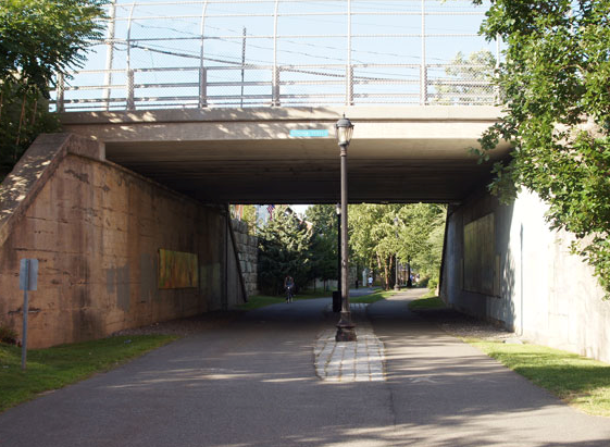
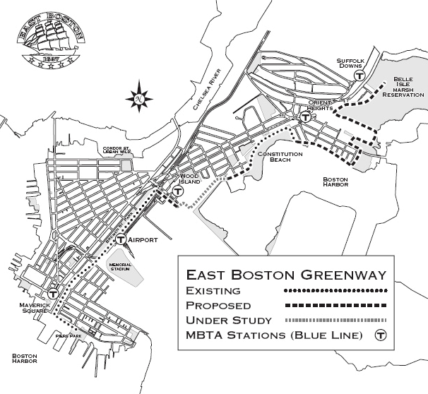
The Mary Ellen Welch Greenway (previously East Boston Greenway) is a mixed-use pathway and linear park built on a former rail corridor" linking several parks in the neighbourhood and also connecting the East Boston district to the beachfront (1, p23). In the 1950s after the Consolidated Rail Corporation stopped using the railways, it became a derelict dumping ground. To the initiation of a local community organisation with the collaboration of governmental authorities, the redevelopment of the area has started as a rail-to-trail conversion program. When completed, the Greenway will link several important open green spaces in the East Boston neighbourhood, increase the acres of park per resident in the area, provide a place for recreational activities and direct greenway to the Boston Harbor (1). Furthermore, with water management amenities the area would serve as a buffer zone in case of flooding by barricading the waterfront. (1)
Overview
Nature-based solution
- Parks and urban forests
- Green corridors and green belts
Key challenges
- Green space, habitats and biodiversity (SDG 15)
- Green space creation and/or management
- Regeneration, land-use and urban development
- Conversion of former industrial areas
- Promote natural styles of landscape design for urban development
- Health and well-being (SDG 3)
- Enabling opportunities for physical activity
- Creation of opportunities for recreation
Focus
Project objectives
Implementation activities
Main beneficiaries
- Non-government organisation/Civil Society
- Citizens or community groups
Governance
Management set-up
- Led by non-government actors
Type of initiating organisation
- Non-government organisation/civil society
- Citizens or community group
Participatory approaches/ community involvement
- Joint implementation (e.g. tree planting)
Details on the roles of the organisations involved in the project
Project implemented in response to ...
Financing
Total cost
Source(s) of funding
- Public national budget
Type of funding
- Unknown
Non-financial contribution
- Provision of land
- Provision of labour
- Public authorities (e.g. land, utility services)
- Citizens (e.g. volunteering)
- Private sector (businesses, financial institution)
Impacts and Monitoring
Environmental impacts
- Green space and habitat
- Promotion of naturalistic styles of landscape design for urban development
- Increased green space area
- Restoration of derelict areas
Economic impacts
- Unknown
Socio-cultural impacts
- Social justice and cohesion
- Improved liveability
- Improved access to urban green space
- Health and wellbeing
- Gain in activities for recreation and exercise
Type of reported impacts
Presence of formal monitoring system
Presence of indicators used in reporting
Presence of monitoring/ evaluation reports
Availability of a web-based monitoring tool
References
2) Boston Planning & Development Agency, (n.a.), East Boston Greenway, Boston Planning & Development Agency, Accessed on 2nd March, 2021, Source link
3) Friends of the Mary Ellen Welch Greenway, (n.a.), About, Friends of the May Ellen Welch Greenway, Accessed on 2nd March, 2021, Source link
4) On the Grid, (n.a.), East Boston Greenway, Accessed on 2nd March 2021, Source link